Category Archives: City rediscovers walking

New York City Installing thousands of Bollards to Protect Pedestrians

New York City mayor Bill de Blasio, New York City Department of Transportation Commissioner Polly Trottenberg, NYPD Commissioner James O'Neill and U.S. Congressman Adriano Espaillat (D-NY) stand near additional bollards in Times Square, New York City

New York City will be installing 1,500 bollards on city streets as reported by the New York Times. While these bollards have previously been installed around Times Square in 2016, they have previously only been installed for diplomatic buildings and some private enterprises.

In May 2017 an individual high on PCP used a rental truck to drive down a bike path on the city’s west side. Eight people were killed. The 50 million dollars spent on securing undisclosed pedestrian locations will include metal bollards and also large planters which will be placed at vulnerable locations. Concrete cubes and barriers previously installed will be replaced with items that are less cumbersome to walk around and that are more aesthetic.

New York City’s mayor de Blasio stated that the bollards were “necessary to immediately secure those areas in light of these new trends we’ve seen. But we knew we needed long-term solutions, we needed permanent barriers. People have to be able to get around, but they have to be safe at the same time.”
Discussion are also ongoing to further limit car access to the Times Square area and also re-evaluate whether vehicular traffic should be further restricted in other popular pedestrian locations.

bollards-gty-jpo-180102_3x2_992

When Hanging Out on a Vancouver Street Was “Loitering”

tom-campbell-on-wrecking-ball-at-the-lyric-theatre-may-1969-courtesy-calgary-herald


It was not that long ago that there were actual bylaws so that people did not just go and sit on a street. Walk Metro Vancouver’s friend in Zurich Daniel Sauter notes that a stay in a European park averages 20 minutes. In North America, an eight minute stay is considered long. And just hanging out on a street is almost a 21st century re-invention.

Time for a voyage back fifty years ago to another time and and another Mayor. Called “Tom Terrific” (and that was not always a  positive term) Mayor Tom Campbell is described in wikipedia as “brash, confrontational, and controversial. During his term, the City held a referendum which authorized the then-controversial development of an underground shopping mall and office towers, now known as Pacific Centre, Vancouver’s largest development… Campbell took an assertively pro-development stance, advocating a freeway that would cut through a large part of the downtown east side, the demolition of the historic Carnegie Centre, and the construction of a luxury hotel at the entrance of Stanley Park (the Bayshore Inn) and another at the north foot of Burrard in which it turned out the mayor had invested (it is now an apartment building and never became a hotel).”

Mayor Tom Campbell was mayor from 1967 to 1972 and was not too happy with the “hippie” movement of the time. Dan McLeod of the Georgia Straight newspaper was beaten by City Police, and the Mayor stopped the 1970 Festival Express rock’n’roll tour from coming to Vancouver, saying he would shut down the festival with police intervention. He was also Mayor during the August 1971 Gastown Riot which resulted in 79 people being arrested, and 38 being charged with different offences. Stan Douglas’s art piece “The Gastown Riot” located in the Woodwards Building Atrium commemorates this event.


2421539


In 1968 Mayor Tom Campbell spoke to a CBC reporter at the Court House Steps, now the Vancouver Art Gallery about hippies, loitering, and why they were a scourge to society. At the end of the interview, one of the “hippies” quotes Shakespeare back to the reporter.

It is an interesting look back at what was considered heinous and unacceptable behaviour. And a reminder~these hippies are Vancouver’s senior citizens today.


Fire Departments Don’t Need All that Space Around Hydrants After All

f7e38qni1q9c1ht-rect2100

While proposed by the Fire Chief in Surrey as a way to give more parking back to communities, Chief Garis’ willingness to review the sacrosanct five meters of parking  clearance required curbside beside fire hydrants opens up the potential for all kinds of new street use. Working for a municipality the requirements for fire hydrant clearances are never questioned, and even in the computer age where every hydrant is tracked and marked on line, even landscaping is ordinanced and suppressed around fire hydrants. Chief Garis questioned the five metre clearances  with Surrey’s City Engineer and while he found that most North American by-laws limit parking to five or three metres away from a hydrant, the requirement could be reduced to half of that.As noted in the Vancouver Courier The National Fire Protection Association in the United States recommends a minimum buffer of five feet, or about 1.5 metres.”


A study showed that parked cars only impeded hydrant access if the setback was two metres or less, and noted that “with the advancement of GPS mapping and related technologies, along with local drivers’ awareness of hydrant locations, visibility is less of an issue in compact urban settings. The space doesn’t need to be large enough for a fire engine to park either, since they rarely pull right up to the curb, and instead block traffic lanes.”


While the Fire Chief saw this as a way to give back space to parking for cars, is this not another opportunity to create more parkettes and widen facilities for pedestrians and cyclists? If there are thousands of fire hydrants in each Metro Vancouver municipality could this not be a way to improve the public realm for active transportation users with benches and other amenities? While the Minister of Transportation is prepared to consider the changes to clearances, the proposal will be going to the Union of B.C. Municipalities for consideration. This might also be an opportune time to explore how else this newly acquired space on almost every block of a municipality can potentially  be repurposed to the benefit of  pedestrian and cyclists.


facebook

Free Webinar on the Business Case for Walkability~August 2!

2322004825_727a0d47f3_z

Thank you to Simon Fraser University’s City Program for offering this webinar hosted by Darren Davis free of charge.

From the Next-Generation Transportation Webinar Series:

“What gets measured gets managed”, conventional wisdom dictates. In the case of quantifying the benefits of walking, this has often been a reactive and piecemeal process, if done at all.

Join us August 3rd for a deep dive into the business case for walking as Auckland Council’s Darren Davis demonstrates how the city was able to reduce barriers to walkability by choosing the right KPIs.

Next-Generation Transportation Webinar Series
The Business Case for Walking – Counting Walking to Make Walking Count in Auckland City Centre
Friday, August 3, 2018, 2–3:30 p.m. (PDT)
Free webinar, but reservations are required. Reserve on Eventbrite by clicking on this link.

It is generally taken for granted that we can measure current motor vehicle travel and predict (read, guestimate) future motor vehicle travel through computerized transport models, while the measurement of walking is often piecemeal and reactive. There are few serious attempts to systematically estimate future walking. In addition, things that we value—such as the quality of the public realm, places to sit and linger, and design for pedestrian safety and space—are rarely given a quantified value and hence, ironically, are often value-engineered out when budgets are tight.

Auckland Council’s Business Case for Walking addressed these deficiencies by valuing the benefits of public realm improvements and increased space for pedestrians with the economic cost of delay to pedestrians and increased productivity, through reducing and eliminating barriers to improving walkability.

Learn more about this award-winning and groundbreaking work from Darren Davis, Transport & Land Use Integration Programme Manager at Auckland Council and lead instructor for the Next Generation Transportation Certificate program at Simon Fraser University.

The Number One Reason People Don’t Walk or Bike to Work??? It may surprise you!


The New York Times takes on the top reason cited by Americans for not biking or walking to work, from a recent survey on active commuting.
That issue? Time.
But, as the Times suggests, the 97 per cent of Americans who don’t use active transportation for commuting may want to rethink their reasoning.


As the Times reports, “a new study published in a journal called Transportmetrica A: Transport Science shows that people often overestimate the time required to commute actively, a miscalculation especially common when someone has secured a parking permit near the office.”
The study of 500 university faculty, staff and students found that estimates of commuting time on foot or by bike were generally poor, with 90 per cent of respondents overestimating the length of their journey to work by over ten minutes when compared to Google maps.

The few assessments close to Google’s were almost always made by riders or walkers. Parking availability and distances affected the estimates. Those with parking permits, a fiercely sought-after campus amenity, tended to overestimate active-commuting times significantly; the closer someone lived to the workplace, the better the guesses. Confidence had an outsize effect, too. The people surveyed, especially women, who had little bicycling experience or who did not feel physically fit thought that active commuting would require considerably more time than the Google calculations.”
Other commuting concerns such as bicycle lockers and accessibility to showers and places to change clothes were not discussed in this study, but time itself appears to be “less of a barrier to active community than many might anticipate” according to Melissa Bopp, a Kinesiology professor who was also the study’s senior author.

“I’d urge anyone who is considering biking or walking to work to do a test run,” she says, perhaps on a weekend (although the traffic patterns will be different from those during the week). Ask colleagues for route suggestions. “Google is good at finding bike paths, but it emphasizes brevity and directness over scenery for walkers.”


employee-walking-bike-on-way-to-work-750x500
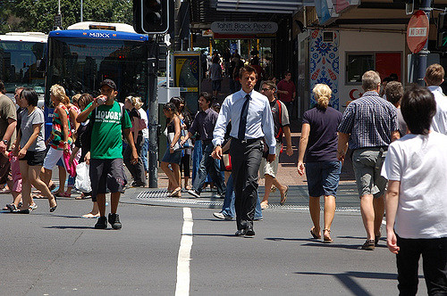
Image: GlassDoor.com

New York City’s Tom Bob Repurposes Street Utilities into Whimsical Wonders


street-art-tom-bob-new-yorkPhoto: Mindcircle.com

From Catherine Clement comes this New York City story about Tom Bob who has turned the ordinary into the extraordinary with every day street amenities.  Taking ordinary items like  manhole covers, bike racks and exposed wall piping Tom Bob transforms them into articles of delight and whimsy. It’s no surprise that his work has also been seen in Boston and has even extended to street signs.

You can see more of Tom Bob on his twitter account and follow his exploration of design and delight bringing a different perspective to the public realm.

street-art-tom-bob-new-york-15-5979857590ea2__880Photo:BoredPanda.com

How Can Cities and Towns become more Walkable?

IMG_0626
Sandy James Photos
From the Daily Durning comes an interesting article from governing.com  on the importance of sidewalks to the liveliness of cities and places. Jane Jacobs’ The Death and Life of Great American Cities established the concept that holistic communities are based upon the opportunity to have face to face contacts with neighbours. Jane wrote: “Lowly, unpurposeful and random as they may appear sidewalk contacts are the small change from which a city’s wealth of public life may grow.”
Sociologist Mark Granovetter  reinforced this view in the 1980’s in an academic review that found the “most successful communities were built on what he called “weak ties,” informal contacts among casual acquaintances who stop on the street to share news, gossip or simple good wishes. A robust array of weak ties gives city dwellers access to jobs, child care and practical advice, and it enhances their overall sense of well-being.”

 
Of course it makes sense that in order to have contact on the sidewalk you need sidewalks and spaces along sidewalks for people to gather. The City of Vancouver has the blooming boulevards program which allows home owners to garden the city boulevards on either side of  the sidewalk in front of their residence.  Windsor Street in East Vancouver was the demonstration street for blooming boulevards, which created gardened spaces and meeting points for the residents along this street.

 
Walk Score is now popular in assessing  how walkable a place is and used by people buying in the real estate market. There is a new book out by Philip Langdon titled “Within Walking Distance” examining why some cities seems to do better with walkability than others. Langdon talks about Brattleboro Vermont, a town that is constrained by geography to a small size but has embraced walkability in its downtown which is also bustling with businesses. It’s the town site located between a river and steep hills that has meant the town could not sprawl outward, and meant that 90 per cent of locals live within a two-mile walking distance of downtown. That walkable distance also has meant that townspeople proudly support local businesses on their main street and spurn more suburban shopping centres.

 
Langdon also examines other American towns and their walkability. He surmises that while history and geography matter for walkable places, neighbourhood character, creativity and “audacity” are important too. Audacity is described as the neighbourhood’s determination in the face of “existing regulation and bureaucratic inertia”.

 
Walkability, its quality and its acceptance is still something best measured by local residents in the comfort and convenience of accessing schools, shops and services by foot, and still remains an area that requires more study.
IMG_0744

Metro Vancouver, We are Jealous of Winnipeg’s Woonerf!

There is a little more Dutch in Winnipeg these days as that city welcomes its first “Woonerf”. As reported in the Metro News this is a street innovation  for pedestrians before vehicles, and achieves “calming the street down through design”.

woonerf_caninassociates
A typical Dutch woonerf

 
The location of the woonerf  at John Hirsch Place used to contain an old rail line. Now there is a curbless lane that  allows for slower vehicular traffic and no delineation between bikes, cars and pedestrians.
There are bollards  near the edge of the lane to keep people from driving on the landscaping (and I have seen bollards in Amsterdam that retract to allow for emergency vehicle entrance). There is seating for walkers which as soon as it was placed became a place to be with the locals.
Besides providing a pedestrian link between Waterfront Drive and a park and further trails,  the woonerf has become a new public space. Similar to the “DeepRoot” cell system installed in Vancouver’s Olympic Village for the ongoing sustenance of the street trees, Winnipeg has installed a similar system for increased street tree soil volume and rain water capture.
While this is only a demonstration project, we all toast Winnipeg for their first woonerf-and suspect with citizen use and demand, it won’t be their last. Meanwhile in Metro Vancouver~when will we get our first woonerf?

 
woonerf01-size-xxlarge-promo

The Best Pedestrian Rest Areas are “Docking” in Parking Spaces

7c5d3e68-ddef-452e-a2b2-a22c8727fde8-mightyo1
Little parklets are those exciting hacks of previous parking spaces morphing into things that well, ordinary people walking around can use. And one of the finest hacks as reported in City Lab is this absolutely brilliant reuse of a 24 foot sailboat now docked in a  Ballard neighbourhood street outside a Seattle donut shop.

You are looking at the Endurance, which now “ only ‘floats’ on the road,” says Megan Helmer, a public-arts enthusiast whose husband founded the donut shop. “The keel has been removed, and the base of the hull cut and placed on cedar decking.”

Seattle actually has a City Department of Neighbourhoods that provides grants for such endeavours. With additional crowd sourced funding, Mighty-O Donuts and community volunteers began constructing the parklet.” 

“The Mighty-O parklet is a great example of what SDOT’s parklet programis all about,” says Brian Henry at the transportation department’s Public Space Management Program. “They brought the community together to talk about what kind of public space should be created, and designed something that reflects Ballard’s maritime character and history. It shows how a neighborhood business can lead the way in enhancing the public realm, and creating more space for people.”

Seattle now has nine parklets that have developed in the last four years.  This parket came after  “onethat encouraged leisurely reading with nearby “little free libraries” and another where people could paint stuff on a board with water and watch it evaporateto “witness the sobering truth that nothing in life lasts forever.”

 Each one of these ideas is so wonderfully perfect.

lead_large

The Elephant in The Yard-Point Grey Road

8727956

The owners of residences on the north side of Vancouver’s Point Grey Road have some of the most spectacular  views of English Bay and the North Shore mountains, unfettered by public walkways between their properties and the ocean. The City of Vancouver used to have a policy to purchase land along the north side of this street, so that all Vancouverites could enjoy the magnificent views. The intent was to eventually provide access to the beach, which is public in Vancouver.  Margaret Pigott Park is one example of a north side of Point Grey Road private property that was purchased for public use.

109897758


While the bikeway portion of the Seaside Greenway has been developed along Point Grey Road, the news for walkers has not been as positive. The city sidewalks on the north side of Point Grey Road are often squished beside the curb, with private landscaping from the large houses encroaching on the city boulevard, making the sidewalk feel even narrower. Most of this private landscaping encroachment consists of hedging and trees.

And then came the elephant. Yes, there was an elephant sculpture installed in the front yard of a house on Point Grey Road’s north side. The property owners fenced the elephant in with a handsome black wrought iron fence that encroached on city owned boulevard land right up to the sidewalk.

.b20m-2zcyaawhlv

In other parts of the city, this does not seem to happen. There is a public understanding that the city owns the land that is called the public boulevard, and that this strip of land extends on both sides of the sidewalk. The location of the water service in front of Vancouver properties is an indication of where the City’s land ownership ends and the private homeowner’s property begins.

water-shut-off-valve-lid

Jeff Lee’s article in the Vancouver Sun describes how homeowners on the north side of Point Grey Road are upset with the city’s plans to upgrade the sidewalk as part of a 6.4 million dollar project completing the seawall walkway. This upgrade will mean the city is taking back city land usurped by private hedges and fences to make a sidewalk wide and comfortable, like the rest of the seawall walkway. There will be a 1.2 meter strip between the homeowner’s front yard and the start of the sidewalk.

The City’s plans were originally to place a seawall walk right beside the ocean, in front of the Point Grey houses. This was nixed by the residents, as well as by environmental concerns.

The Point Grey residents held a rally on Sunday protesting the installation of the sidewalk, claiming it was an example of bad fiscal spending and citing the challenges residents would have in exiting their properties in vehicles with walkers and cyclists on the city street.

But here’s the point-taking back this strip of city owned land and putting it in public use for walkers is not about today, it is about tomorrow. Anywhere else in the city I would argue we would have dealt with this landscape encroachment on a popular walking street years ago. It would have made sense to have implemented this wider sidewalk at the time of the adoption of the expansion of the Seaside Greenway. The  properties along Point Grey Road benefited from a huge real estate lift the moment this street was designated.  That was the time to negotiate the return of the public boulevard for the safety, comfort and convenience of  walkers, people pushing strollers, and wheelchair users.

Hopefully future generations of Vancouverites can vision the Seaside Greenway as a stroll, not just a bike ride. How we deal with these issues today by following established city policy and protocol shapes the public realm, our public spaces, and our future place. There will be no more elephant in that yard.