All posts by admin

Coming Up~Crossing the Street Can Kill You in Vancouver’s Winter Months

15505995_g

Vancouver is in an unusual situation. Unlike most large Canadian cities we do not normally get snow and live in a habitat with  lots of tall trees and a lot of rain. These factors make walking in Vancouver’s low light winters a challenge. Snow does provide some light bounce, and does make cars go slower.  In 2016 nearly one pedestrian a month was killed on the City of Vancouver streets. Most were over 50, and most were men. The majority of pedestrian deaths in the Province died while legally crossing the road in a marked intersection.

An interview  by the CBC  points out that 40 per cent  of all pedestrian deaths in the Province occur in November, December and January. Of that amount 61 per cent were over 50 years and more than one-third were over 70 years of age. The 2017 numbers for pedestrian deaths are not released yet  from the B.C. Coroners Service for the Province. Price Tags has recently written about the fact that pedestrian signal crossing time  is not long enough for many seniors, and that the standard crossing times for the elderly  are being internationally challenged.

On a per capita basis, Vancouver has a worse record of killing pedestrians than the City of Toronto which is actively campaigning to reduce road violence. “recent survey released by ICBC revealed that nine out of 10 drivers worry about hitting a pedestrian at night, particularly in wet weather, while eight in 10 pedestrians don’t feel safe in those conditions.”

The Provincial Medical Health Officer has written Where the Rubber Meets the Road trying to halt the 280 annual  deaths (47 in Metro Vancouver)  from automobiles in the Province, and the 79,000 who are injured. Vulnerable road users, those using active transportation have increased in fatalities, comprising 34.9 per cent of all fatalities in 2013. Road design, speed, driver behaviour and visibility are all aspects of road safety and achieving Vision Zero as set out in Europe. The safety of vulnerable road users is now a public health priority in British Columbia and in Toronto, and we need to design our streets and slow down vehicular speeds as if every road user’s life truly does matter.

Because pedestrian deaths in the City of Vancouver are simply not acceptable.

vancouver-pedestrian-safety

Why Can’t We Build “Great Streets” for Pedestrians?

140905-pico-sitevisit2287229


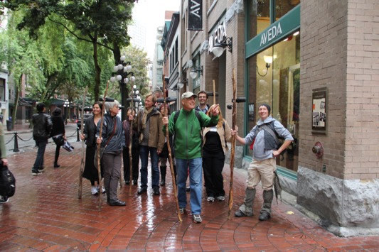
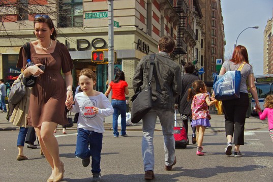
There is a shift in the conversation about the rights of pedestrians and cyclists to travel comfortably, conveniently and safely on Metro Vancouver streets. This discussion has been highlighted internationally in the media and you can take a look at almost any historic street photo from the early 20th century and see a surprising truth~in the early 1900’s pedestrians and bikes mingled and crossed streets, with vehicles either interspersed or travelling a slow enough speed to allow for such passage.


view-of-the-400-block-granville-street-from-west-hastings-street


While in the early 20th century cities and streets were still being designed as if pedestrians and not cars shopped there, streets then morphed into emphasizing automobile movement and motordom efficiency. Getting places faster was always  from a vehicle driver’s perspective, not that of pedestrian.


The Toronto Star’s Christopher Hume describes it this way: Streets have also become the forgotten element in our efforts to create a livable city. In Toronto, the focus is on parks, housing, towers and transit; streets are left to fend for themselves. At the same time, however, streets are under more pressure than ever as the historic dominance of the car is challenged by other groups, namely cyclists and pedestrians. The car has wreaked untold damage on our streets as well as our cities. Its needs are at odds with those of the urban environment. Cars are quick. Cities are slow. Cars want highways, fast roads that run as straight as possible with as few interruptions as possible. City roads, by contrast, must accommodate not just vehicular traffic but the activity that unfolds along its edges, the shops, restaurants, museums, malls, schools, cafes, courts . . .


Hume also notes that there are no “Great Streets” in newer towns and cities. The art of street building has been lost in the bid to champion accessibility of the car.  Matthew Fleischer of the Los Angeles Times notes that in Los Angeles pedestrian collisions have doubled in two years with a 58 per cent increase of fatalities. Efforts to slow traffic down, change design and driver behaviour have resulted in “political backlash” to City Council whenever pedestrian safety is improved. As Fleischer observes “the rising body count seems to indicate that pedestrian safety falls somewhere between tree trimming and gum removal on their priorities list.”

Economic studies clearly show that designing streets for walkers and bikers increases the retail success of  businesses on commercial streets. Instead of looking at walking, biking and vehicular traffic as pieces that need to be protected from each other, more integrated approaches are needed to holistically design for all modes, to get back to the early 20th century concept of street. One of the most important urban design elements in the 21st century will be the design of streets that capture the sociability, health, and connectivity of streets from a pedestrian and cyclist perspective. Allan Jacobs started this conversation in his book Great Streets looking at the components that made these streets successful, welcoming, and sticky for pedestrians. Wresting control of our own great streets  from motordom will be this century’s challenge.


granville-street-looking-north-from-about-dunsmuir-street-1900-city-of-vancouver-archives

What to do With An Old Highway Overpass~Seoullo’s 7017 Walkability Response


Last winter Walk Metro Vancouver was invited to be a plenary speaker at a pedestrian think tank and conference in Seoul Korea. One of the highlights was reviewing  Seoullo 17 with architectural planners from the Architectural Urban Research Institute.  This extraordinary Sky Garden was built upon the 1970 Seoul Station Highway Overpass in South Korea, which was going to be demolished because it was structurally unsafe.

fullsizeoutput_914


The Seoul Station Overpass is one kilometer long and 17 meters (55 feet) above the ground, roughly the same height as Vancouver’s Georgia Viaducts. Instead of demolishing this overpass, it was seen as a catalyst for urban regeneration and linkages in an area that was previously disconnected for pedestrians.   In 2015 HRVDV won a competition to design a this 33 million dollar project as an arboretum which has 254 species of trees, rhododendrons, and plants (all labelled and in alphabetic order on the Sky Garden).  There are 24,085 trees planted and 645 large pots placed along the Sky Garden. There are baby trampolines (carefully constructed in conical forms), plant sculptures, a bakery, a library and even a nursery. The project opened in May 2017 and has been praised for its  adaptation of a motordom artifact.

fullsizeoutput_93c


There is great attention to detail in the finishings and the construction,  and the Sky Garden is bathed in blue light in the evenings. It is used by people of all ages for walking and for visiting, and is seen as an “observatory” over the different lanes of vehicular traffic below. One of the desired outcomes was for users to become more aware of the heavily used streets  and the glassed in guard rails  of the Sky Garden invite that conversation. There is also an “observatory” platform on the Sky Garden for a more bird’s eye view. The designers have playfully cut large diameter cores into the centre of the overpass and placed clear plexiglass covers over those holes so that pedestrians can view for themselves the “structural integrity” of the bridge’s inner workings.


DSCN0166View from Seoullo 17 of TrafficDSCN0136One of several entrances to Seoullo 17 integrated into new plazas at ground level

Like the High Line the Sky Garden has been very popular with local citizens and the travelled width of the walkway is only fifteen feet, the same width as much of High Line in New York City. Adminstrators now say that they wish the pathway widths had been a bit wider, but no one anticipated the overwhelming use and acceptance of the space. Even the wayfinding and local maps  are  now designed with the Sky Garden being the central artery to scores of attractions, shops and services from the many entrances to the elevated walkway.  Seoullo 17 has quickly become a central part of Seoul’s revitalization and you can view more about the project’s background and opening day in this YouTube video.


That Semi-Private Space~is it Public or is it Private?

3151

The Guardian has written about the rise of that  open public space that appears to be public but can be controlled by developers who actually built the space. That seems to be the case in Great Britain “where Pseudo-public spaces – large squares, parks and thoroughfares that appear to be public but are actually owned and controlled by developers and their private backers – are on the rise in London and many other British cities, as local authorities argue they cannot afford to create or maintain such spaces themselves.”

The situation is a bit different in the City of Vancouver where access to space or easements through large developments are negotiated as part of rezoning development, and are accepted by developers in exchange for items like higher density or height. These agreements are maintained for the public to have access on property that would normally be in the private realm. And they also enable developers to build more on their properties in exchange for the perpetual maintenance and use of a portion of the site.

Large developments may also be required to keep a certain portion of their interior for the use of the public, such as the amenity area on the second floor of City Square at 12th Avenue and Cambie Street.  A former development planner was aghast when a coffee area tried to brand that amenity space as part of a coffee bar instead of as a resting lunch place open to all the public who ventured there.

In Great Britain these private open public spaces colloquially called “Pops” are not subject to local authority agreements as they are in Vancouver and are instead provided at the whim of the landowner. In looking for the governance and regulation of fifty such sites in the City of London the Guardian newspaper could find little information. In response, Mayor of London Sadiq Khan will be indexing and compiling a list of all of these semi public spaces, and looking at how to monitor these public spaces. The new London Plan aims to have a more transparent approach to semi private public space, forming agreements with developers on the use and access of public areas as part of their development agreements.

As Matthew Carmona, an urban planning professor at the Bartlett School observes “Public space, whoever owns it, should be open and free to use, and these things need to be guaranteed at the time that we as a society give permission for developments to happen, But cities like London have always had diverse combinations of ownerships, predominantly public but also private and semi-private. There’s all sorts of complications and nuances which I think fail to be understood by claims that all privatisation is bad, and all public ownership of public space is good. I’m not interested in using the issue of privately-owned public spaces as a surrogate for a larger political argument. I think there are many instances where private spaces are well-used and enjoyed, and contribute socially and economically to the city.”


5670


Walk or Bike to Work, Save Billions of Dollars

4259

The British  non-profit Sustrans has been examining governmental plans to increase walking and cycling and have figured out that if the plans are implemented within ten years, that 13,000 lives will be saved and nearly 9.31 billion pounds or 16 billion Canadian dollars still in coffers.

The CEO of Sustrans stated “The new findings reiterate that walking and cycling have a huge role to play in tackling the air quality crisis that causes tens of thousands of premature deaths every year. If we are to make a major modal shift, we need to provide a network of direct protected cycle routes on roads in addition to quieter routes across the UK.”

That’s an interesting thing to talk about protected bicycle routes, as air pollution in Great Britain causes 40,000 early deaths a year. The toxicity is mainly from diesel vehicles in the form of nitrogen dioxide. Many British towns and cities do not meet the WHO guidelines for mitigating air pollution, the most dangerous, PM2.5 coming from vehicle tires and brakes. “A report last month revealed that every area in London exceeds World Health Organisation limits for PM2.5.”

“Sustrans, in partnership with the environmental consultancy Eunomia, found that if targets to double journeys by bike and increase walking by “300 stages per person” in the England’s Cycling and Walking Investment Strategy were met, this would prevent more than 8,300 premature deaths from air pollution. This would result in £5.67bn in benefits over 10 years through the avoided costs associated with poor air quality, including NHS treatment in hospital for respiratory diseases.”  

Modal change from vehicles “to bikes, not diesel for electric” is the best way forward with even bigger savings if the wider impacts to health and well-being of physical activity were encouraged. This is the first time that Sustran’s data has been used with public health data to ascertain the impact of walking and cycling on a person’s exposure to air pollution.  “Our analysis suggests investment in cycling and walking has considerable potential to improve local air pollution. We believe this innovative model could be of considerable value in supporting local authorities and government as these bodies consider options to tackle the air pollution emergency at a local level.”
dqmtrjlwaaafutw

Navigational Apps Turning Quiet Walking Streets into Carmegeddon

screen-shot-2017-12-09-at-20508-pmjpg-1b3f8fee272a5292


You may relate to this. In a Delta neighbourhood there is a  residential street that  is the shortest distance between two arterial roads, favoured by GPS apps, tradesmen and taxis and is a block shorter for arterial short-cutting  cars.There are no sidewalks, no indication that pedestrians are walking on the street which includes a blind corner on a hill with no pedestrian clearance. At 50 kilometers per hour the inevitable has happened, with high traffic volumes and speeds resulting in the killing of a neighbour’s dog, one transmission gutted on a front lawn and cars ending up in neighbours’ yards and through their hedges. Add in a few nearby “golf” communities where older seniors drive to services in their garaged polished cars at speed through this  residential street to get to an arterial. The fact it is a residential local  street and that short cutting should not be happening is not of interest to the GPS apps or drivers, and puts local walkers and cyclists  at risk.

Kudos to  Leonia New Jersey (across the Hudson River from New York City)  which realized that these “alternative routes” don’t just manifest themselves in driver behaviour, but are also suggested by services like Google Maps, Waze and Apple Maps. As the New York Times  notes these apps have resulted in traffic-choked towns where people have been circumventing traffic and choosing shorter routes due to GPS services.  And Leonia  has had enough: “In mid-January, the borough’s police force will close 60 streets to all drivers aside from residents and people employed in the borough during the morning and afternoon rush periods, effectively taking most of the town out of circulation for the popular traffic apps — and for everyone else, for that matter.”

“Without question, the game changer has been the navigation apps,” said Tom Rowe, Leonia’s police chief. “In the morning, if I sign onto my Waze account, I find there are 250,000 ‘Wazers’ in the area. When the primary roads become congested, it directs vehicles into Leonia and pushes them onto secondary and tertiary roads. We have had days when people can’t get out of their driveways.”

The Waze app uses crowd sourcing to update its information which has resulted in some neighbourhoods “fabricating accidents” to stop the flow of motorists using the app. While defending the app’s right to reroute vehicles from congested roads to residential streets, Waze also says it “shares free traffic data with municipal planners nationwide”, as if the good of more vehicle planning outweighs the rights of residents to the safe and comfortable use of their street. Indeed Waze says that if a road is “private” it will not be used by the app. How many “private streets” in your community?
Unlike other communities that have installed turn restrictions and speed humps, Leonia’s approach has been proactive against congestion and short cutting caused by apps. Residents will be issued special tags for their cars, and other users of the street will be fined $200 in the rush hours. The police department has notified the major traffic and navigation apps of the changes and fully intends to enforce local use of their streets. While other elements like traffic barriers or street closures are the more preferential way to keep traffic out, the approach taken is a policing one.  As the Chief of Police of Leonia says “It’s basically all or nothing . It’s a very extreme measure for very extreme traffic. Would I prefer not to do this? Of course. But I would rather try something and fail than not try anything.”


navigation-app-car-shutterstock-700px

Tree Canopies and Cities~Who Has the Biggest Tree Canopy?

17058081907_93db0450fb_k

From Walk Metro Vancouver’s colleague in Australia Greg Vann  comes this article from the World Economic Forum on trees. We all know that trees are wonderful. They eat carbon dioxide. They give off oxygen. They change the way we psychologically feel, and there’s evidence showing that being surrounded by trees is very good for your mental and physical health. So which city has the most trees?

Trust the MIT’s Senseable Lab partnership with the World Economic Forum to come out with “Treepedia”. Using Google Street View a “Green View Index” was created with “a rating that quantifies each city’s percentage of canopy coverage based on aerial images. ”  You can take a look at the Treepedia index here.
And below are the top-ranking cities for trees, with the percentages expressing the amount of tree coverage:

15. Tel Aviv, Israel — 17.5%
14. Boston, Massachusetts — 18.2%
13. Miami, Florida — 19.4%
12. Toronto, Canada — 19.5%
11. Seattle, Washington — 20%
10. Amsterdam, Netherlands — 20.6%
9. Geneva, Switzerland — 21.4%
8. Frankfurt, Germany — 21.5%
7. Sacramento, California — 23.6%
6. Johannesburg, South Africa — 23.6%
5. Durban, South Africa — 23.7%
4. Cambridge, Massachusetts — 25.3%
3. Vancouver, Canada — 25.9%
2. Sydney, Australia — 25.9%
1. Singapore — 29.3%

You can learn more about Treepedia from one of its developers, Juan Pocaterra on this YouTube video.

treepedia-map-mit-vancover-geoawesomeness

New York City Installing thousands of Bollards to Protect Pedestrians

New York City mayor Bill de Blasio, New York City Department of Transportation Commissioner Polly Trottenberg, NYPD Commissioner James O'Neill and U.S. Congressman Adriano Espaillat (D-NY) stand near additional bollards in Times Square, New York City

New York City will be installing 1,500 bollards on city streets as reported by the New York Times. While these bollards have previously been installed around Times Square in 2016, they have previously only been installed for diplomatic buildings and some private enterprises.

In May 2017 an individual high on PCP used a rental truck to drive down a bike path on the city’s west side. Eight people were killed. The 50 million dollars spent on securing undisclosed pedestrian locations will include metal bollards and also large planters which will be placed at vulnerable locations. Concrete cubes and barriers previously installed will be replaced with items that are less cumbersome to walk around and that are more aesthetic.

New York City’s mayor de Blasio stated that the bollards were “necessary to immediately secure those areas in light of these new trends we’ve seen. But we knew we needed long-term solutions, we needed permanent barriers. People have to be able to get around, but they have to be safe at the same time.”
Discussion are also ongoing to further limit car access to the Times Square area and also re-evaluate whether vehicular traffic should be further restricted in other popular pedestrian locations.

bollards-gty-jpo-180102_3x2_992

Instagram, A Gastown Parking Lot, and Reporter Christopher Cheung

582x388xlotspotting-puppy-ferrari-pagespeed-ic-vuzxplqxde

Christopher Cheung has written a delightfully fun piece in the Tyee about his foray into the instagram world of people photographing~well, themselves. His office window is smack adjacent to a popular instagram location on the top of a Gastown parkade. These people all came to the top open deck of the parkade to photograph not the area, the view, but themselves. And that is where Christopher’s story begins.
“All visitors have a mobile phone or DSLR in hand. They aren’t there to photograph buildings; they are there to photograph themselves in front of buildings, dressed in a diversity of styles: preppy, street and vintage throwbacks. Most of it is for Instagram. The app has 800 million monthly users (and counting) sharing images from their lives, sharing creative content and connecting over hobbies. Celebrities, small businesses and global companies use it too. Aside from simple portrait photographers, there are other surprises. I’ve seen skateboarders record tricks on video. I’ve seen TV crews shoot fight scenes. I’ve seen teens set off a bomb of blue smoke for dramatic effect. And, strangest of all, I once saw four guys — all in black, puffy jackets — place a puppy in front of a Ferrari for photos.”

Since most of us would doubt that four duffle coated men would put a small white dog in front of a Ferrari and photograph it on the roofdeck of this rather derelict rooftop parking lot, Christopher provides the photo. Surprisingly even though his office window overlooks the parkade he is largely ignored by the instagrammers. It seems, just like in real life, when someone is in pursuit of a great photo of themselves outside distractions are superfluous. Even taking photos of the instagrammers taking photos was mostly ignored.

“I don’t know why I didn’t think to document these visitors earlier — especially the ones who set off the blue smoke bomb. But from then on, I was determined to capture all who came up to the rooftop to visit.”
And of course Christopher placed his photos of people taking photos on instagram at @lotspotting. He also has a fullsome discussion on the use of instagram in rediscovering these lost corners of the city, and revisits the magic of Vancouver photographer Fred Herzog in the candidness and reality lacking in the instagram staged photos.

“Urban windows are a curious thing. They are part of the voyeurism that is life in a city. Looking through them from the street or looking through one at the street stirs both isolation and intimacy. American artist Edward Hopper captures one such window in Nighthawks, which has become an iconic image of urban loneliness. The painting shows four figures in a downtown diner late at night. They are appear to be strangers, but are sharing a moment together. The perspective is from the outside looking in. Instagram isn’t so different from urban windows.”

851x567xlotspotting-couple-pagespeed-ic-pvxdclx6bbPhotos~Christopher Cheung

Moving Pedestrians with that “Hissing” Noise


If you have been walking on Vancouver’s Seymour Street between Robson and Smithe you have probably heard it~kind of a high-pitched hissing noise, with a bit of a pulse to it. And no, it is not a heat pump or something related to a building’s air conditioning. That sound is actually a deterrent to keep loiterers and folks that would otherwise chat, sit near, or take up space near the parkade running the noise.

Called the Mosquito, this technology was invented  in Great Britain and has a patented small speaker that produces a high frequency sound that can be heard by people who are 13 to 25 years old. That sound is broadcast at 17 Kilohertz (KHz). For older people, and in this case the Seymour Street sound, the setting is at 8 KHz and can be heard by people of all ages. There’s even a way to put place the Mosquito in a “royalty free” music channel, to ward away teenagers but attract older people. “Classical or Chill-out music that would keep the teenagers away to some extent…Launched in the year 2008, it is popular among clients who prefer to use music as one of the strategies to deal with anti social behavior!”

So back to Seymour Street~as reported by CBC News, a guy walking his dog noticed his pup was upset walking along this block. He found that the noise emanated from a box mounted in a stairwell in a nearby parkade, and was designed to deter people from gathering there. Calling these “audio pigeon spikes” a complaint was made to the City of Vancouver. And apparently others have noticed this noise as well, making walking down the street unpleasant for passersby.

Rob De Luca, public safety director for the Canadian Civil Liberties Association, said the devices can be disruptive when used near public spaces, like a busy sidewalk.

“Broadly, these things can raise some concerns,” said De Luca. “The experience can be painful for certain people. It can very much be a blunt instrument. It doesn’t discriminate on people who are offending or not offending — it hits all ears alike.”

It appears that the Mosquito devices are legal in Canada and the complaint has been forwarded to the Vancouver Police Department.  It is worth checking out the comments section of the CBC article where commenters have listed other locations where these Mosquito devices are installed. And if you want to hear how annoying the Mosquito noise is, you can hear this sound by following this link.


mosquito1